Published: 7th January 2019.
Updated: 11th July (added 10 photos)
Introduction:
On the day of my arrival at the coast of West-Java (Anyer-Carita area) there had been 13 days since Krakatau had triggered the Tsunami waves, on the 22th December. I was there at that time too and I have written a detailed account on this, if you are interested you can read it here.
According to Indonesian authorities, preliminary investigations show that maybe as much as over a half of the island was involved in the landslide/flank collapse. It is this collapse that is thought to have caused the Tsunami waves that occurred on the 22th December. The volcanic Island of Anak-Krakatau was around 338m tall before the flank collapse, and a few days after the event, the Indonesian Authorities said they had measured it to be only around 110m tall. On satellite images it seem that the whole summit-cone of Anak-Krakatau collapsed in the event. The forested part of the Island also seem to have perished.
Activity at Anak-Krakatau was ongoing prior to my arrival on the 4th January. According to the Indonesian authorities the crater-vent was now situated partly or fully submerged under water. The ongoing eruptions was said to be Phreatomagmatic/Hydrovolcanic, so called Surtseyan. (read more about Hydrovolcanic eruptions here). Phreatomagmatic/Hydrovolcanic eruptions are generated from the interaction of magma/lava with water.
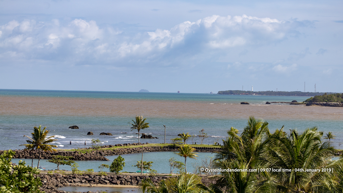
In the morning of the 4th January I arrived by the coast, and started documenting the activity at Krakatau, this time from 48km away. I had taken a few extra safety precautions this time, among other things I stayed on 5th floor or higher during most of my time in the area. The area I stayed in this time was not hit hard during the Tsunami. I am not sure why, as the Tsunami waves created much more damage only few km South of this location, located at the same altitude above sea-level. However at the beach there were relatively much debris washed up ashore. There was also some yellow coating on the beach and on some of the water surface, it looked and smelled like sulfur. I found a lot of pumice on the beach, but it looked like old pumice that have been washed ashore, not new material. However the sulphur coating looked fresh, and I think its likely from Anak-Krakatau, because it looked similar to the yellow layers seen floating around Anak-Krakatau after the collapse on the 22th December, visible on aerial photos.
Below are some notes on my observations of the activity at Krakatau on 4-5th January.
Activity of the Volcano:
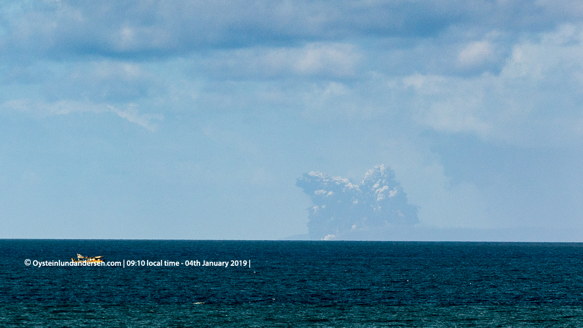
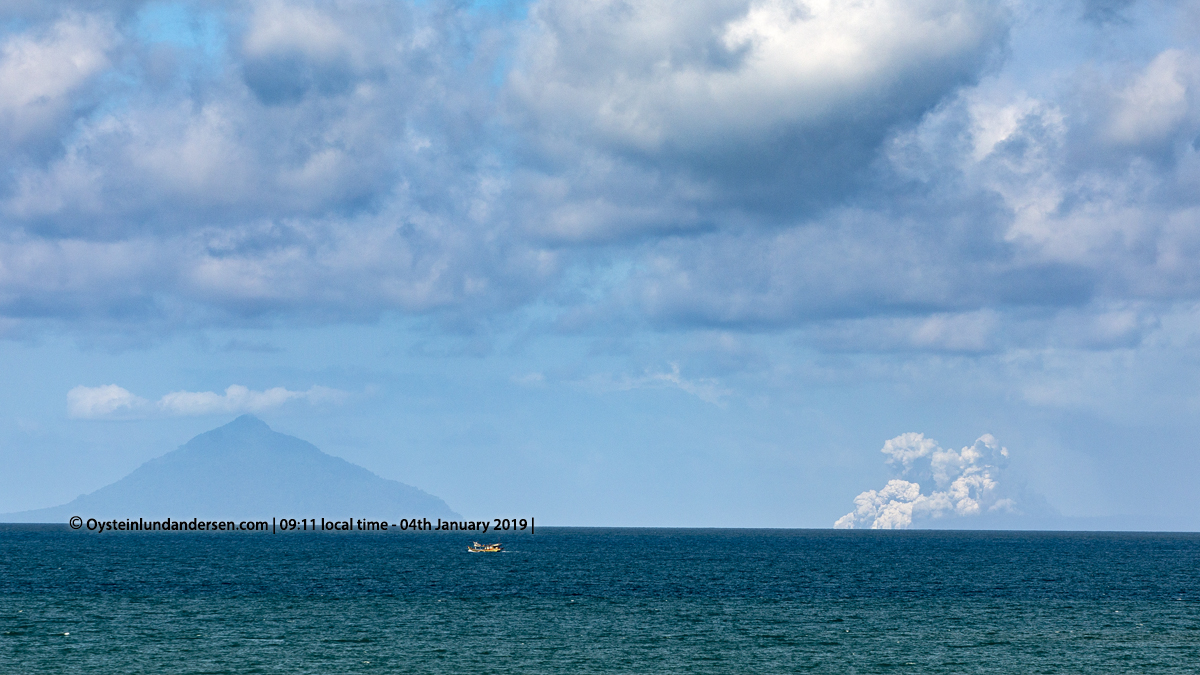
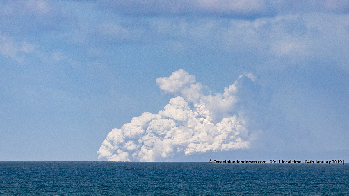
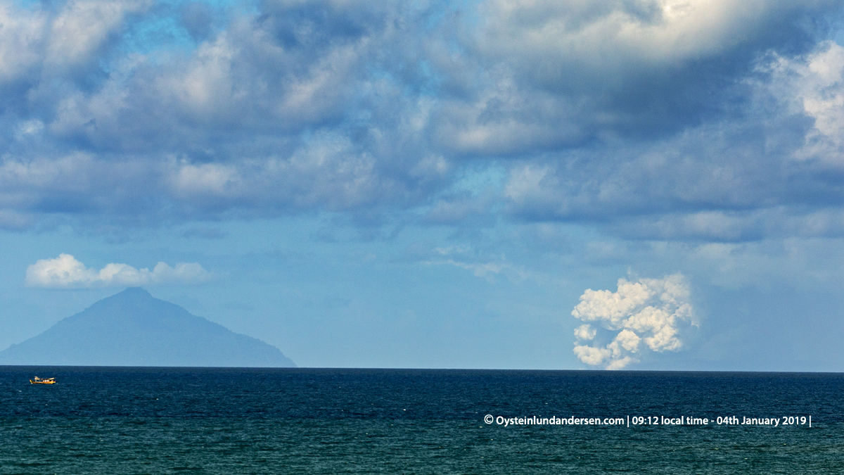
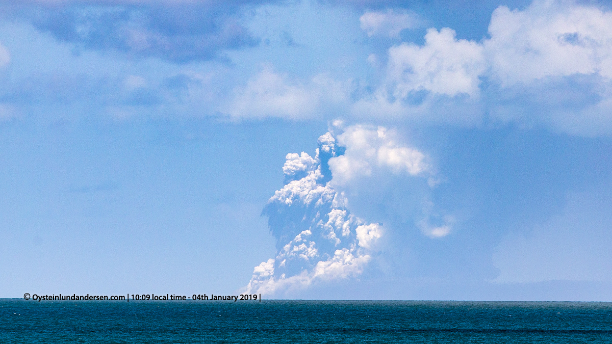
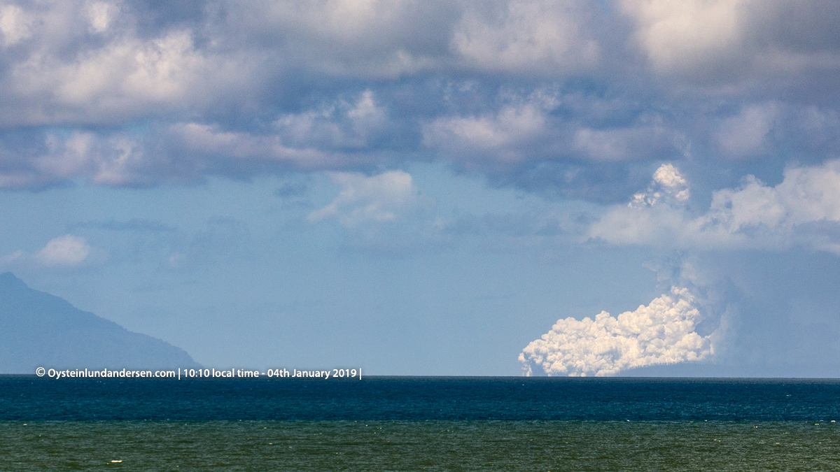
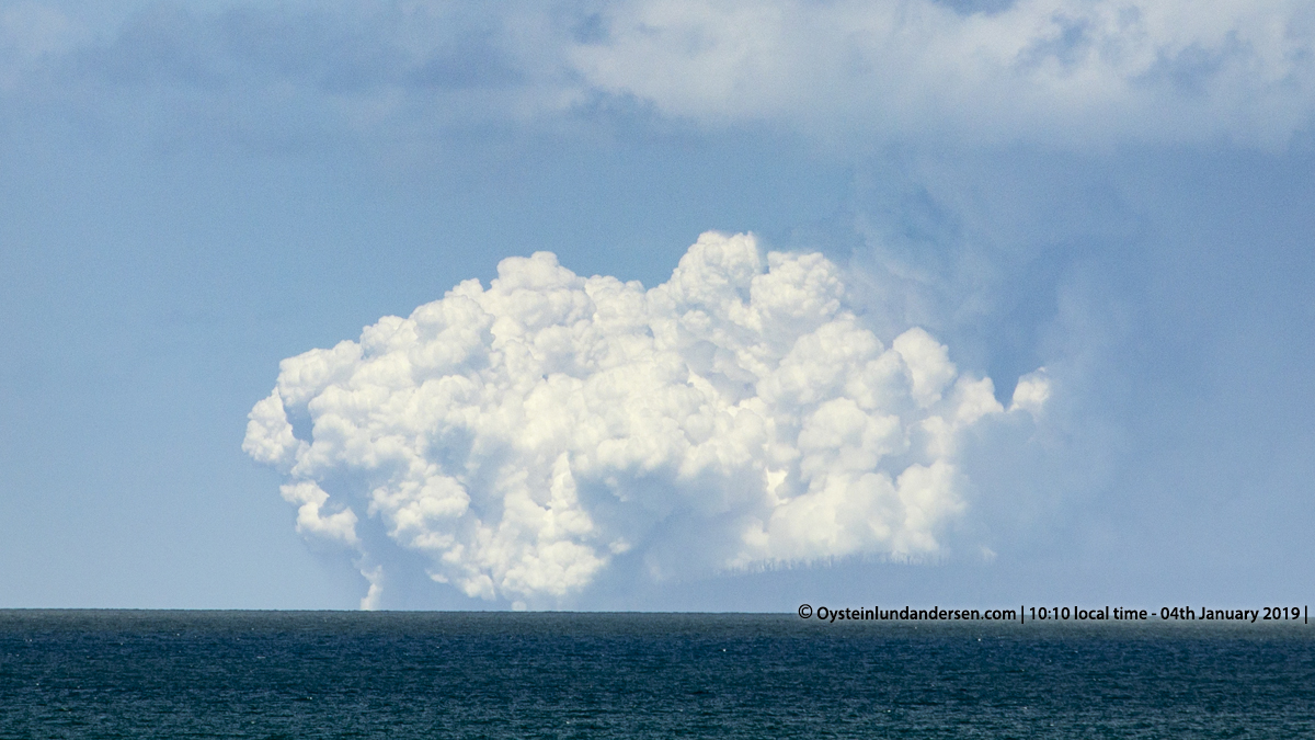
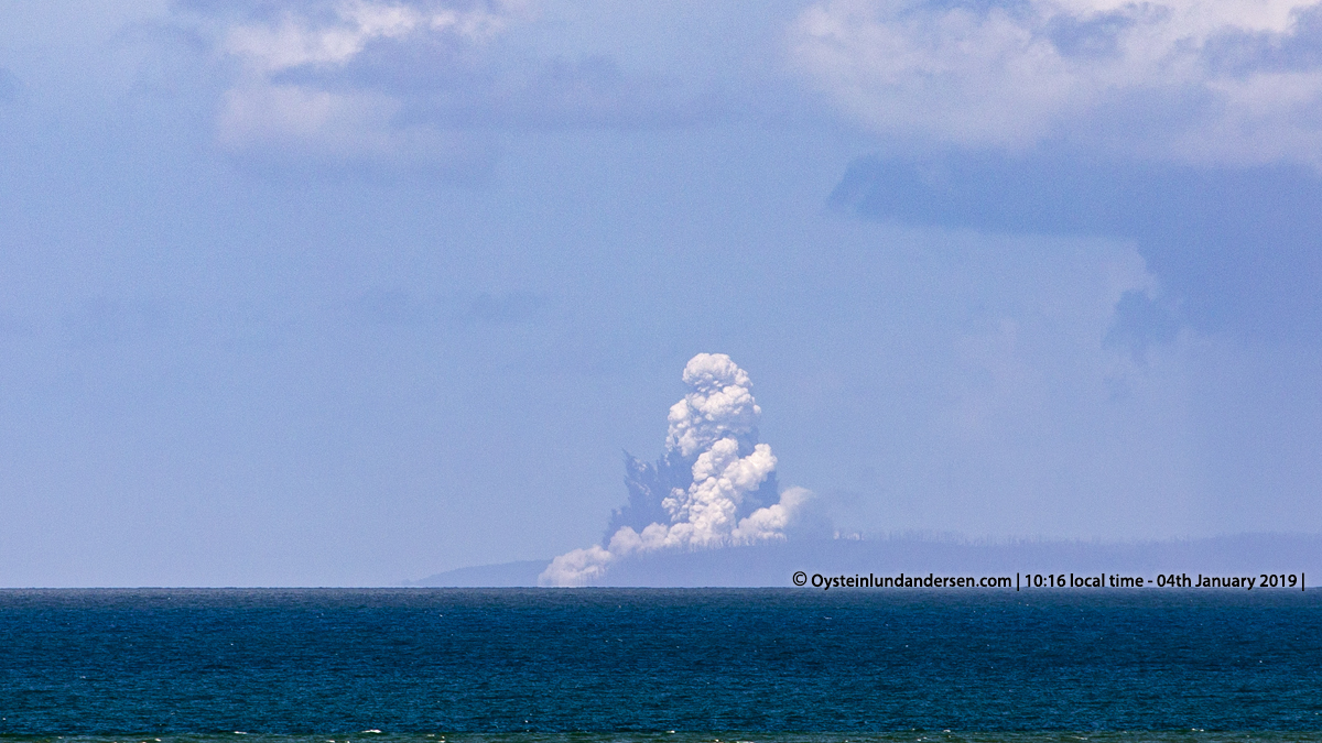
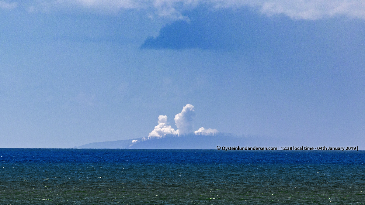
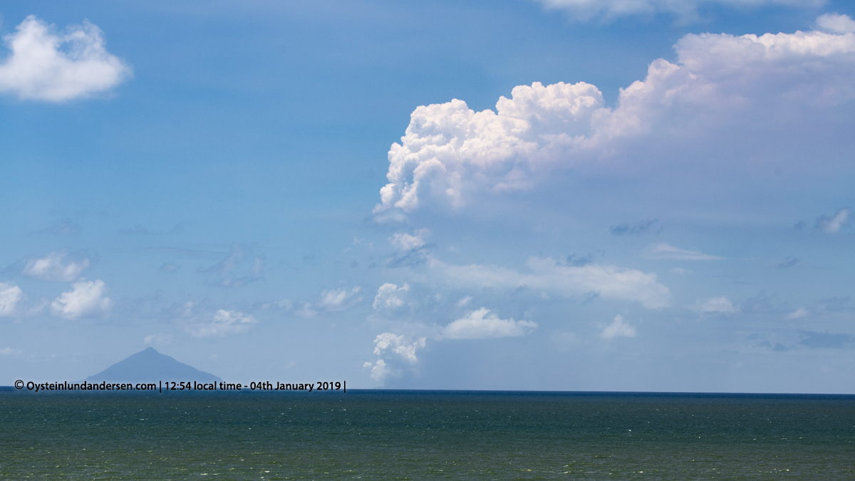
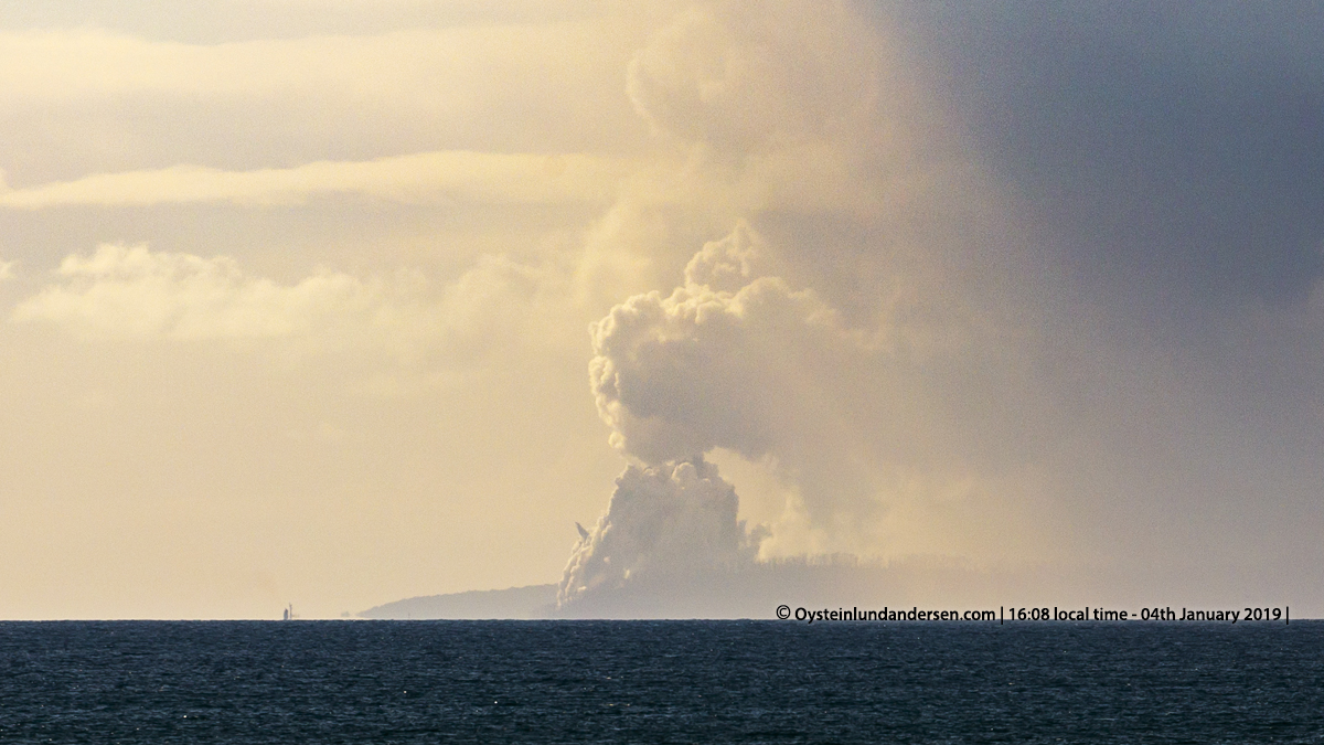
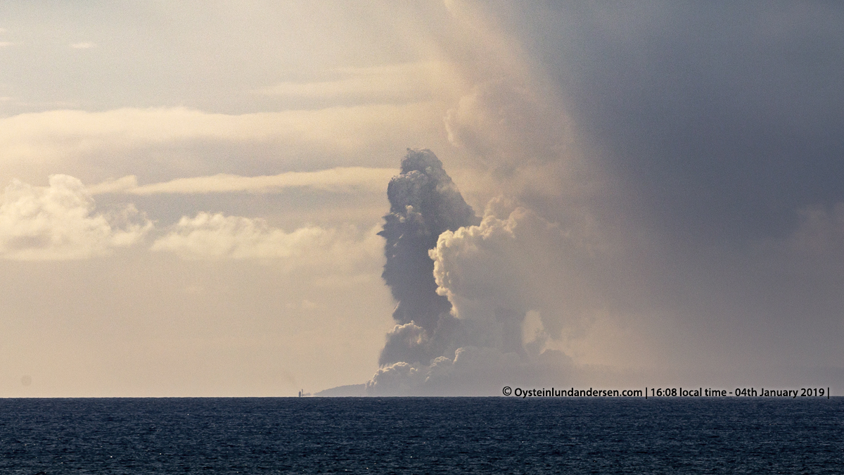
On arrival the weather conditions was clear with good clarity. I could clearly see the Island of Rakata (813m tall), but Anak-krakatau which is now much shorter than it used to be before the flank-collapse, is more difficult to spot from the coast of Java. However I could spot white steam plumes above Anak-Krakatau. Within a few minutes of observing, I saw and photographed the first eruption. A sudden explosion sending black tephra jets a few hundred meters up in the air. After a couple of seconds the black eruption column collapsed down on itself, and a white base surge emerged. (see photo 1-4). From what I understand this is Phreatomagmatic, Surtseyan eruption. (see video no.3, a collection of eruptive activity observed on the 4th January.)
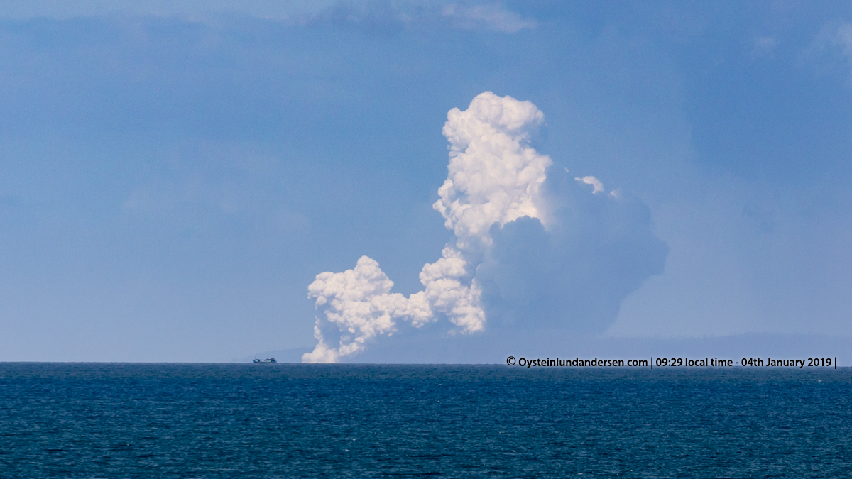
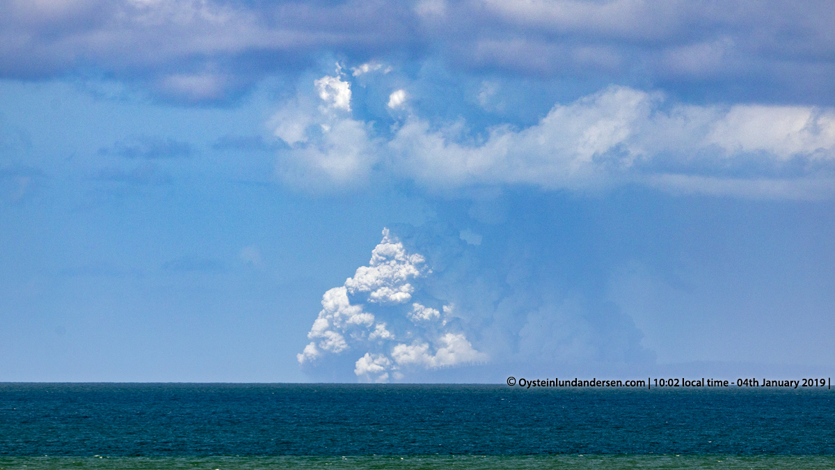
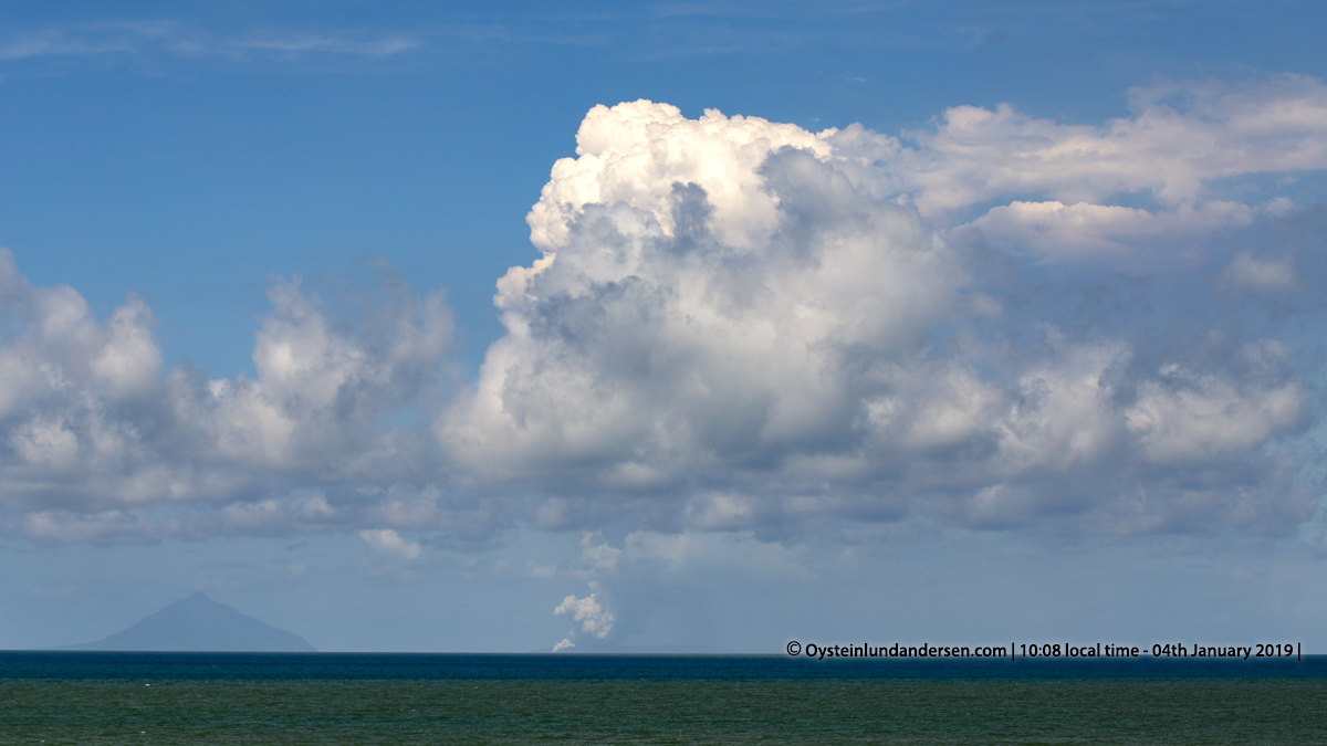
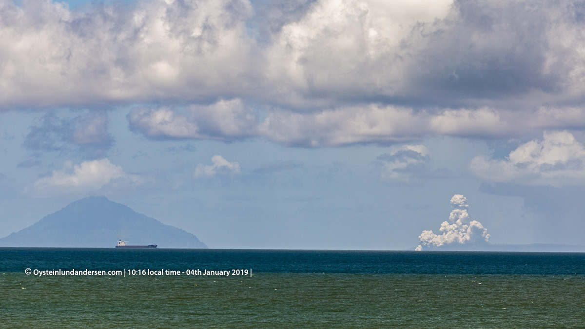
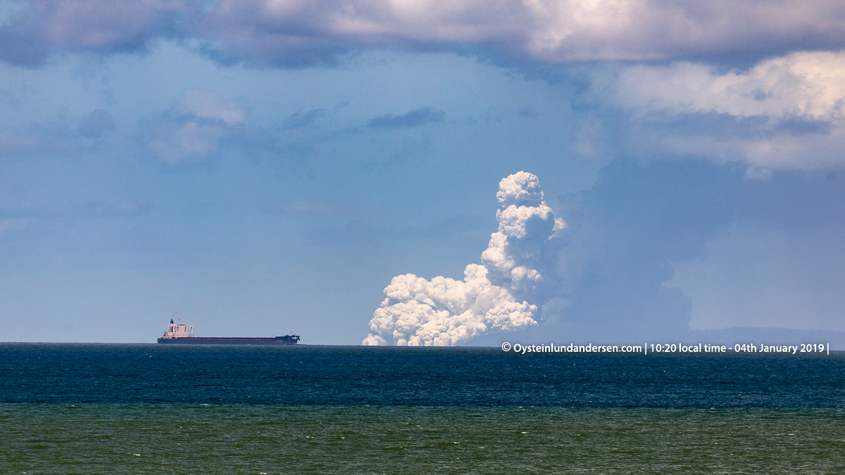
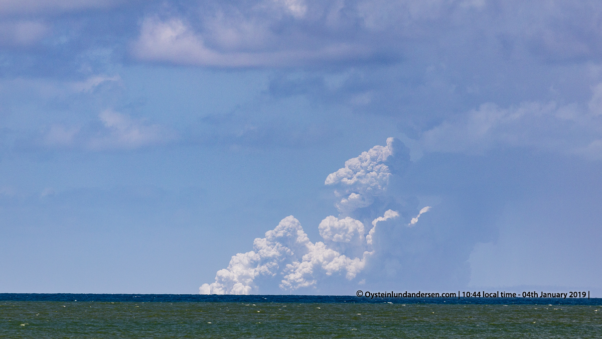
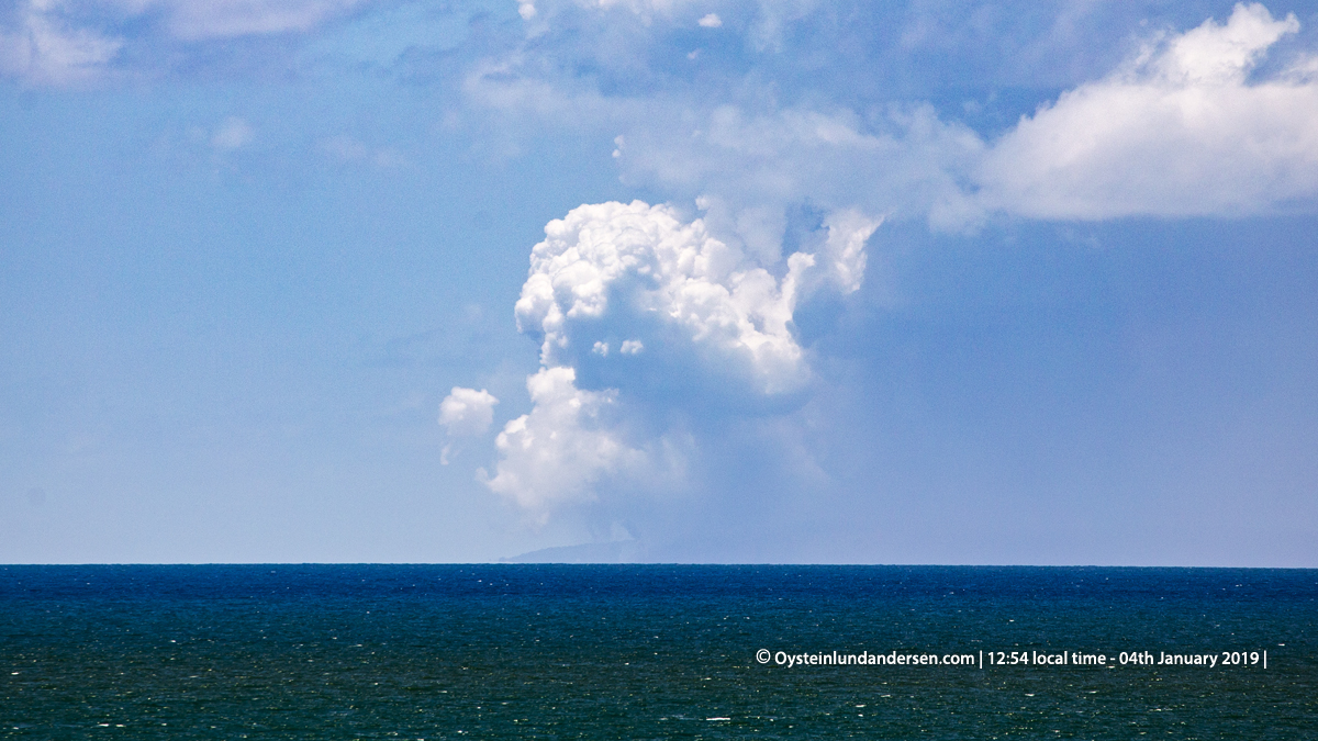
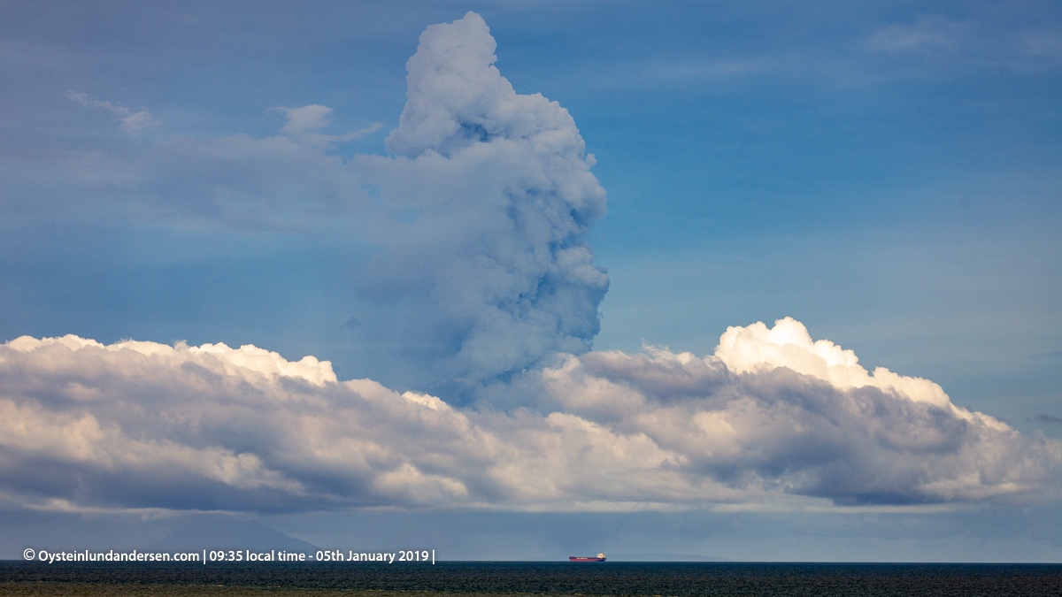
Activity continued with Surtseyan eruptions occurring every other minute, and other less intense white plumes rising from what seemed, different parts of Anak-Krakatau. At around 10:00, it became obvious that the activity (steam) of Anak-Krakatau was feeding a bigger plume that was rising to great heights above the volcano (see photo 8). At this point maybe reaching 4000m above sea-level. (Darwin Volcanic Ash Advisory – VAAC had on 4th January reported of Volcanic ash up to around 30000ft).
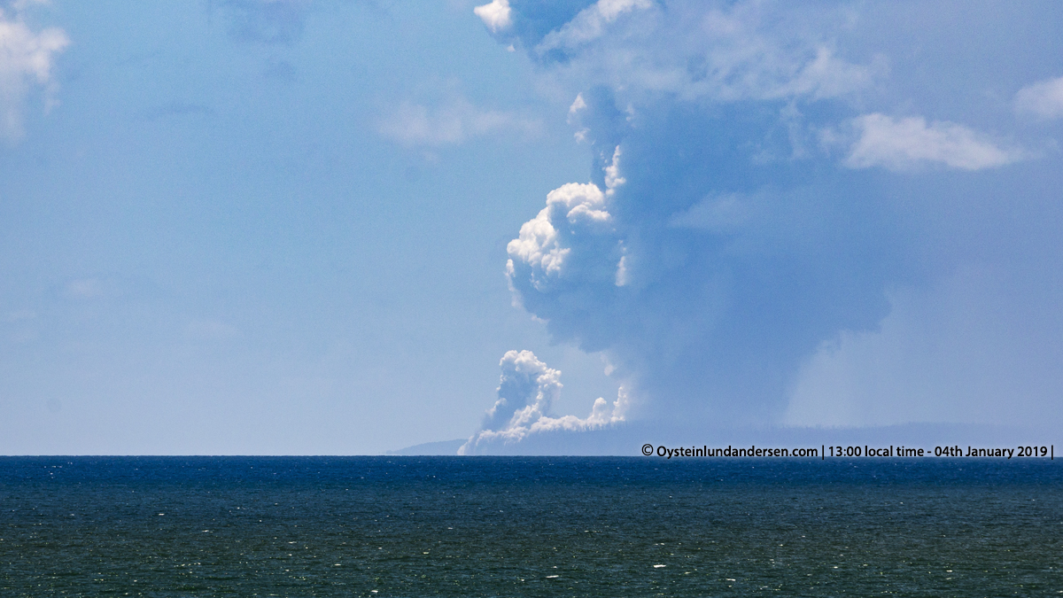
The eruptive activity throughout 4th January was almost continuous, so that in certain periods the whole area around Anak-Krakatau were shrouded in what looked like a dense white(-grey) cloud. The were almost no wind during the day and afternoon, so the plume rose vertically. Some explosions were larger than others, a few (See photo 9, 23 & 25-26) sent black tephra jets to heights almost as tall as the Island of Rakata (813m). A few eruptions sounds (booming noise) were heard between 14:20-14:45 local time.
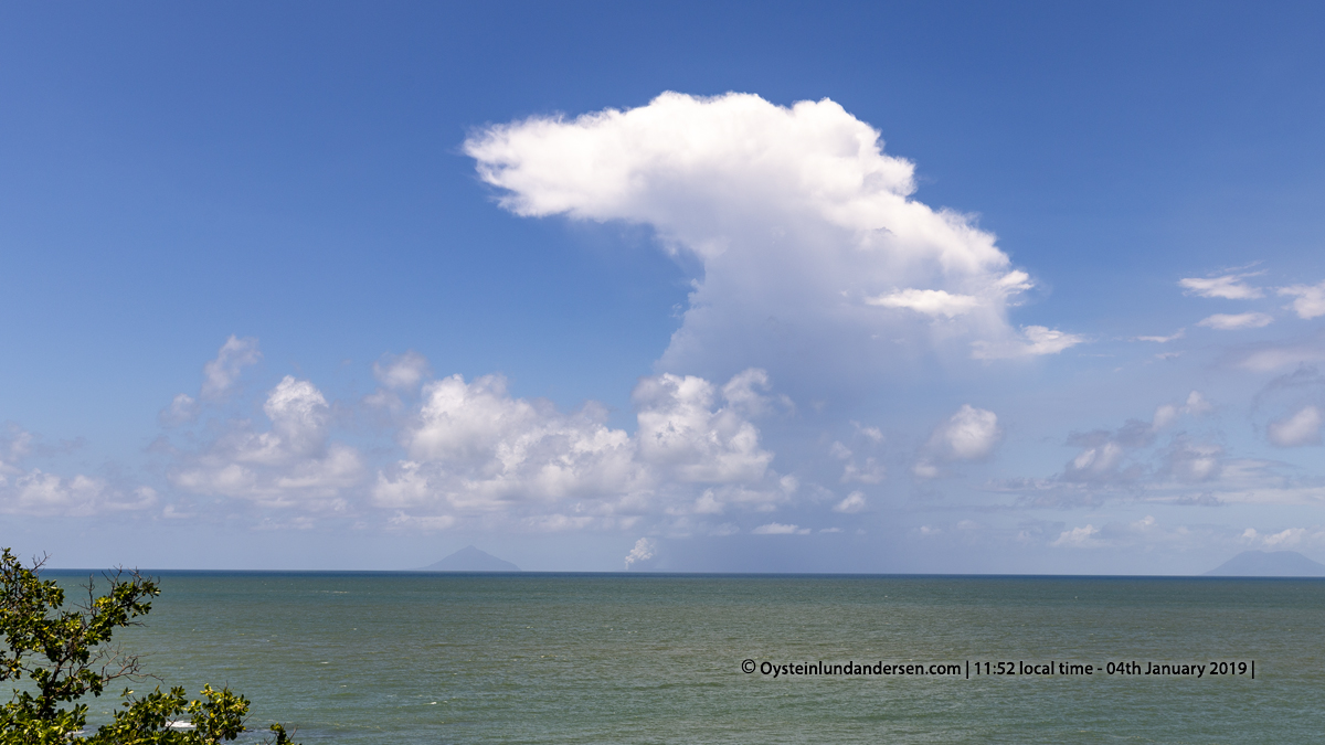
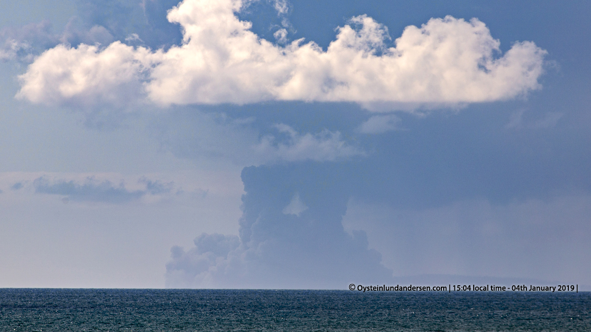
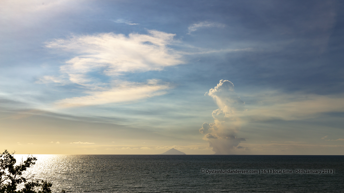
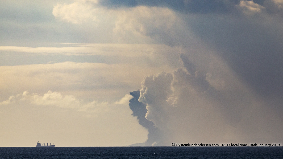
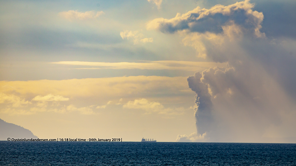
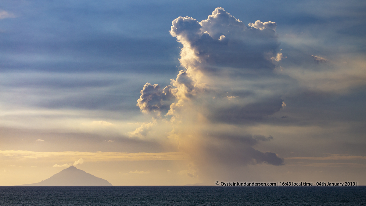
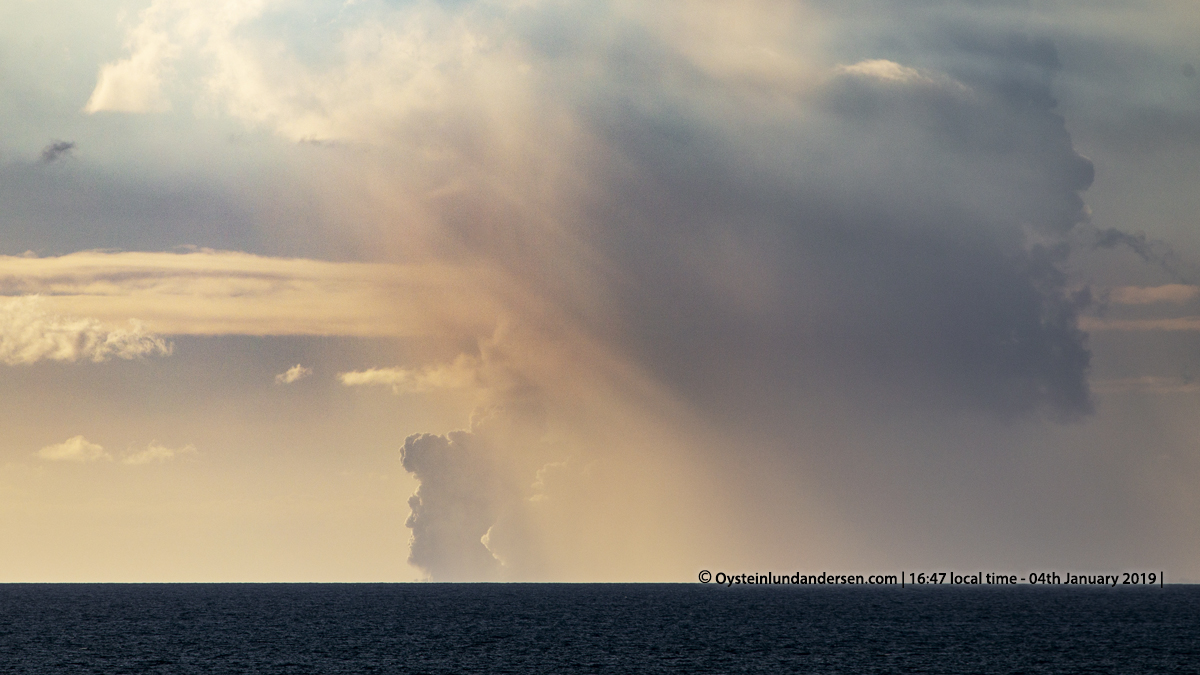
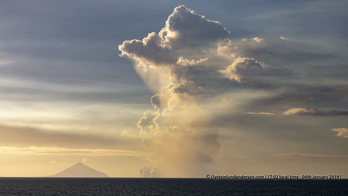
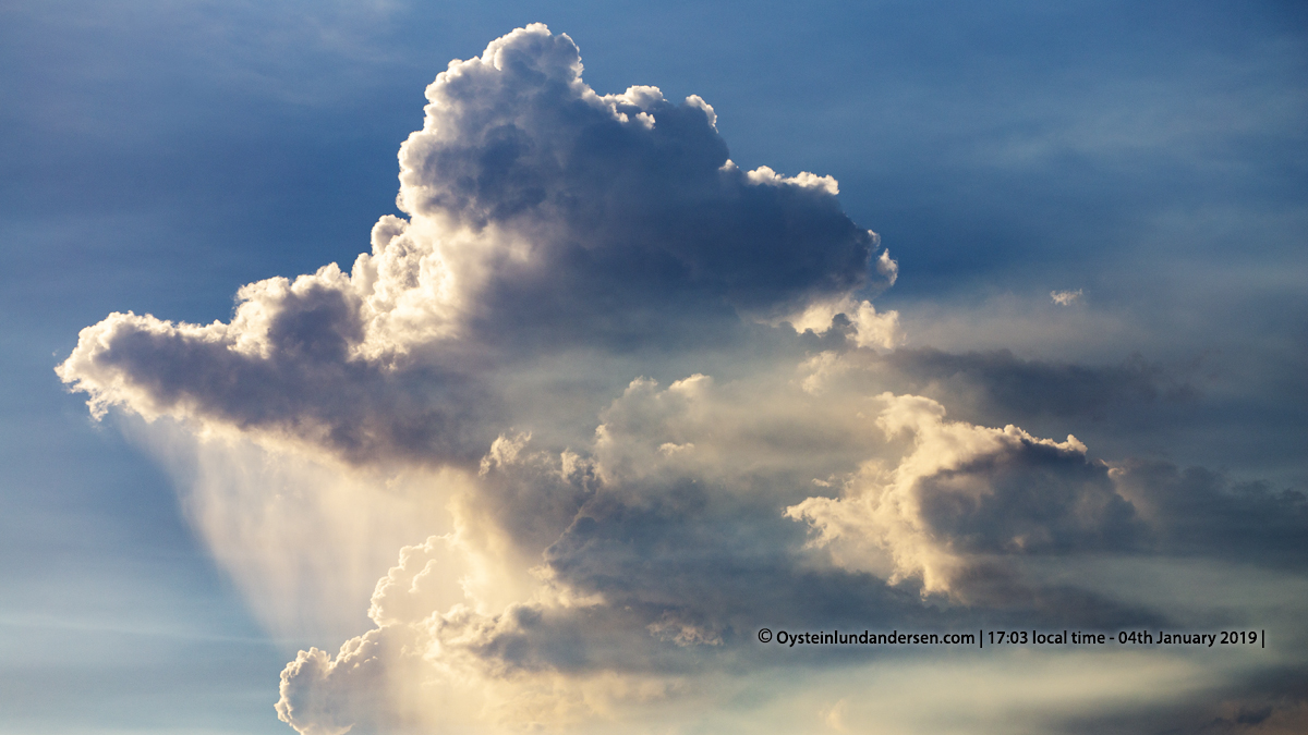
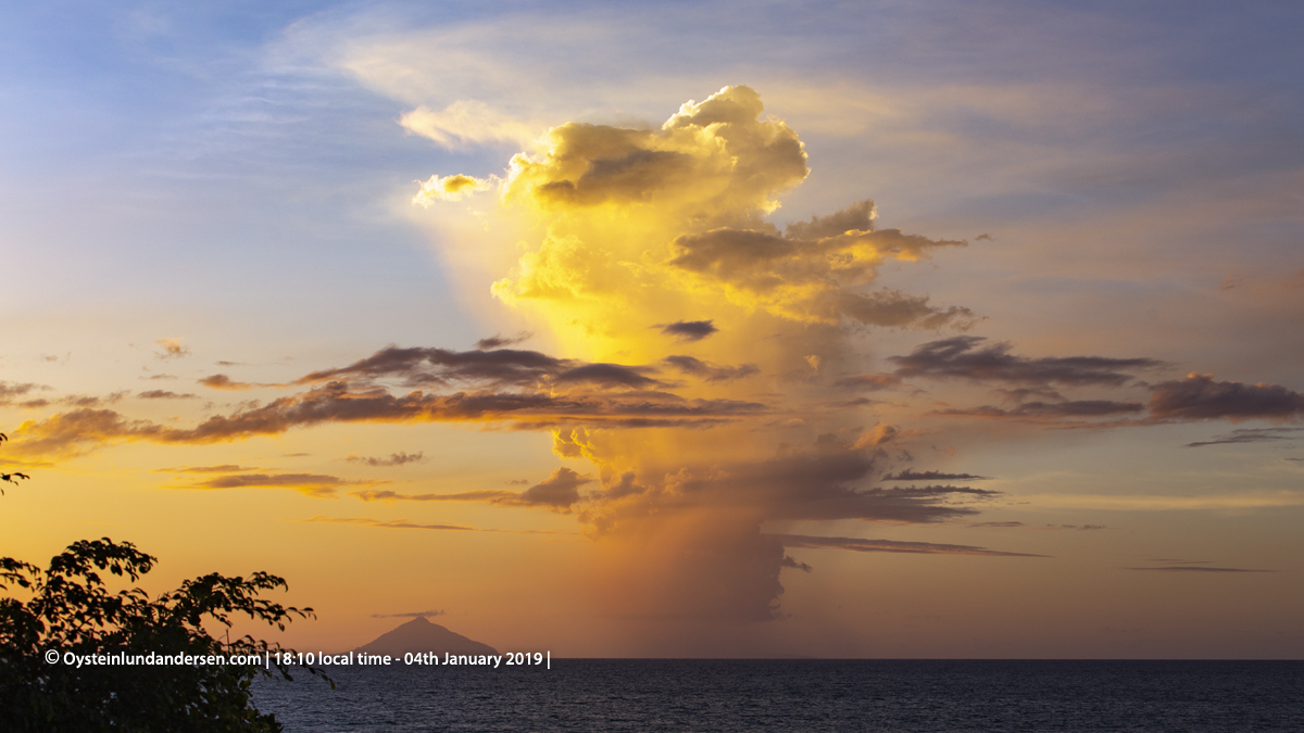
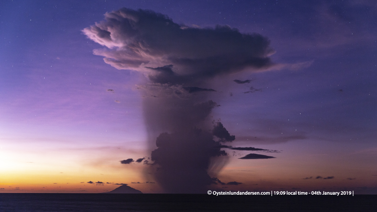
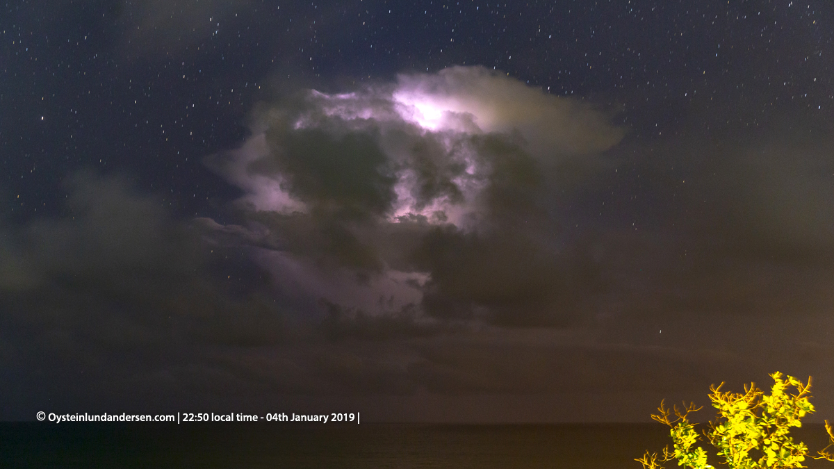
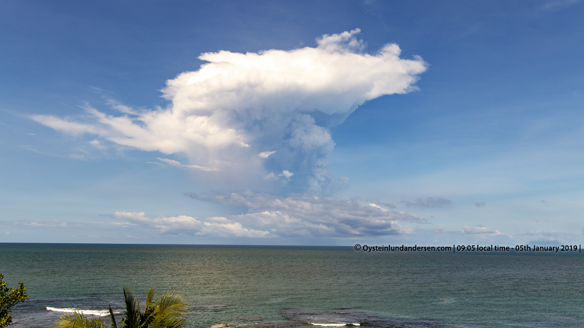
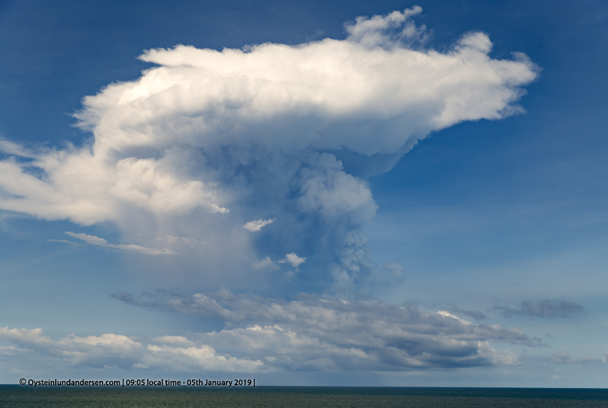
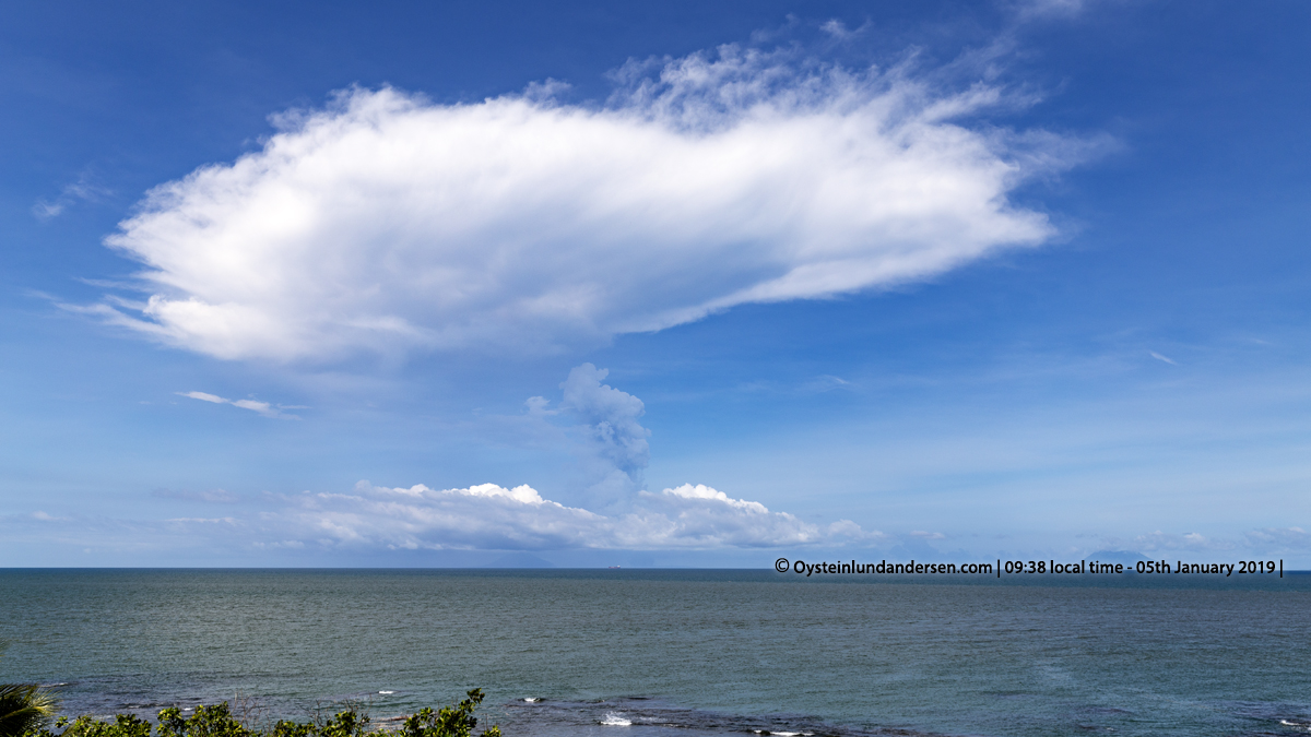
The growing eruption plume/cloud above Anak-Krakatau rose to a great altitude in the afternoon, fueled by steam produced by the volcano. The highest I have ever seen at Krakatau. It must have reached heights to around 10000m above sea-level or even more, according to several sources that have studied my photos. (see photo 32 & 33). In the afternoon, evening and early morning on the 5th January lightning in the growing plume/cloud over Krakatau were observed. (see photo 34). It was interesting to see that during periods of more intermittent (not continuous) eruptions and steam production, the upper part of the cloud that looked and behaved like a cumulonimbus cloud, got separated from the updraft part of the cloud. And then when new episodes of stable steam produced by the volcano, it started to feed the plume/cloud again, and the updraft part of the cloud got connected once more to the upper part of the cloud. (example see photo 40, and video no.1). I have never seen this phenomenon at this scale before at a volcano.The huge cumulonimbus cloud was kept alive, above the volcano for many hours. In regard to this plume/cloud, in the afternoon of the 4th January I noticed another interesting optical phenomena. It is was like the clouds gave off a white/bluish looking material, that looked like streaks of a fine material once released from the cloud. Once released I thought it was ash, however it behaved almost like fluid on the sky, not really like drifting ash. But I guess the most probable explanation is that it was ash, maybe just very fine-ash? The material drifted off in what looked like a S & NE direction. Note: A reader of my post (Sapphire Wanmer Via Twitter on the 8th January) commented “that the clouds might contain some sulphur and if that could be producing the different colours in the upper part of the plume”.
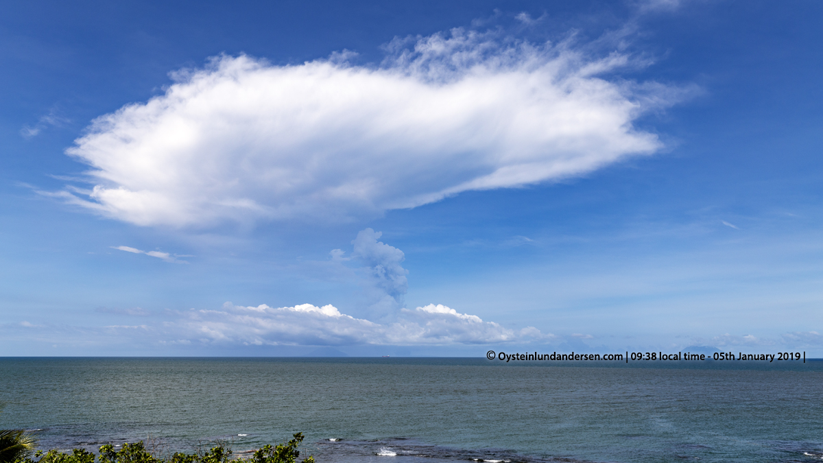
During 5th January activity had decreased somewhat. Less explosions were observed. Weather was a bit more hazy, observation not as easy as the day before. But a tall plume was observed over the volcano during the whole morning, but didn’t reach the same high altitudes as the day before. The lower part of the plume was observed to have a grey color during a few hours in the morning. (see photo 38 & 40)
During my observations in the area, I did not notice any ash-fall occurring in the area I stayed. However according to volcanic-ash advisory, the plume from Anak-Krakatau on 4-5th January did contained ash.
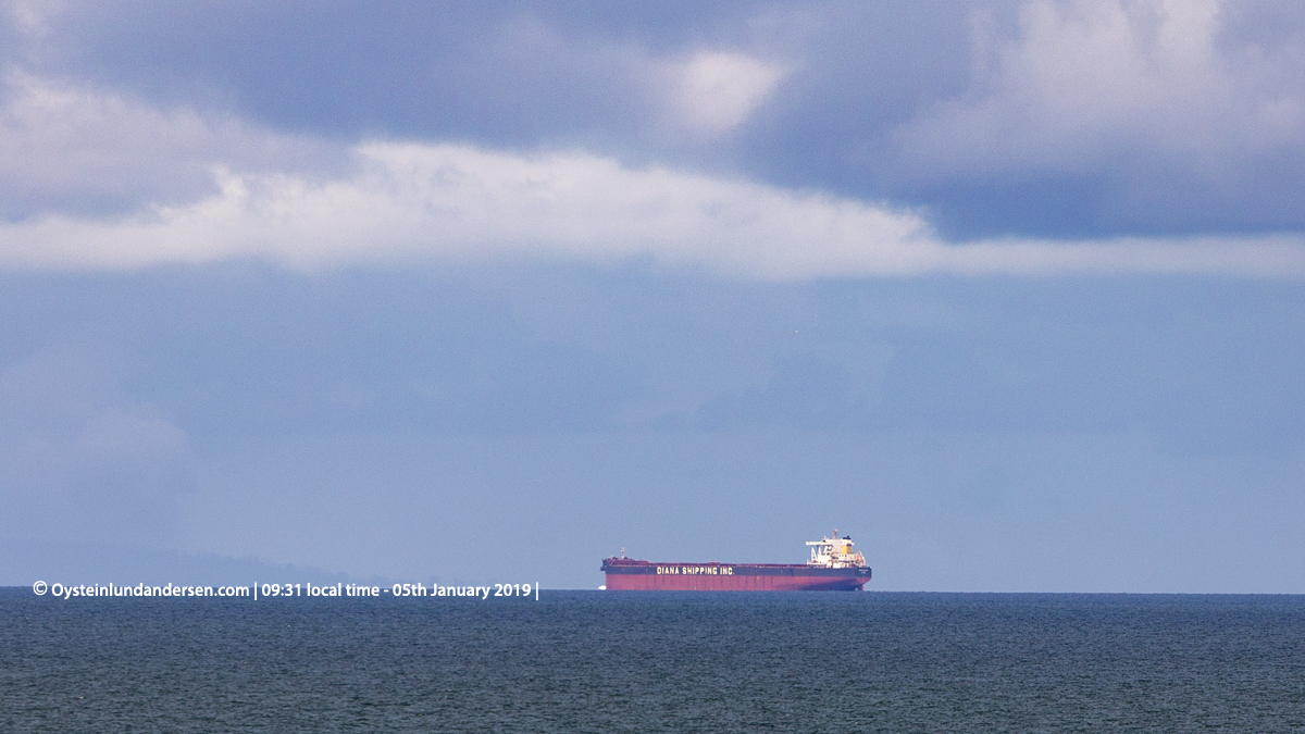
Ship-traffic in the Sunda Strait seem normal during my stay, as I saw a lot of large shipping vessel passing trough.
I ended my observations and left the area at around 12:00 local time on the 5th January.
Important Note:
This is my personal notes, and should not be considered as Official information regarding the volcano or its activity. For updated information and official statements on the volcanic activity of Krakatau Volcano, visit the Indonesian authorities website MAGMA Indonesia. and Center for Volcanology and Geological Hazard Mitigation`(PVMBG) and BMKG – Indonesian Agency for Meteorology, Climatology and Geophysics. On Twitter (@id_magma , @vulkanologi_mbg and @infoBMKG)
The restriction/danger zone for Anak-Krakatau is currently (as of 7th January) at 5km from the summit-crater of Anak-Krakatau, recommended by the Indonesian `Center for Volcanology and Geology and the volcano is at Level 3 (Orange/Siaga)
____________________
Total photos in this article: 40 (Available in Jpg/Raw.). (200+ photos not published)
Total videos: 3 (Available in 4K).
Photos and Videos published are available for purchase only. If you want to purchase photos or videos, please see this page
____________________
4-5th January
